Image
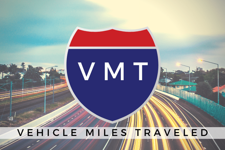
Vehicle Miles Traveled
Vehicle miles traveled (VMT) is a measure used extensively in transportation planning for a variety of purposes. It measures the amount of travel for all vehicles in a geographic region over a given period of time, typically a one-year period. It is calculated as the sum of the number of miles traveled by each vehicle. Use this map to visualize several VMT scenarios throughout the City of Hayward.
October 29, 2020
Hayward Community Food Distribution Map
While developing our Food Action Plan, we partnered with Chabot College and California State University - East Bay to host 18 Food Action Plan college interns who worked with partners to gather data about current existing food distribution sites throughout the City of Hayward and the surrounding areas. This interactive map was created using the data that was collected.
To explore our community food distribution map and filter the distribution sites by open hours and other features, click on the blue map button below.
9/18/25
Image
Crime
Updated nightly
Development Pipeline
Interested in investigating a map of most building and planning projects throughout the city? Please visit our Development Dashboard, browse around and click on projects to see the details. You may filter the types of projects by clicking project types in the chart.
Updated nightly
Image
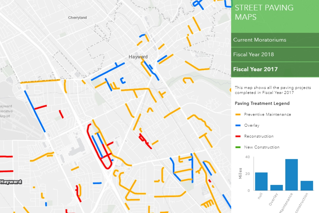
Pavement Moratorium and Street Paving History
View our map detailing the history of street paving. See what streets are currently under moratorium and check the pavement work done by fiscal year.
Updated on August 30, 2021
Image
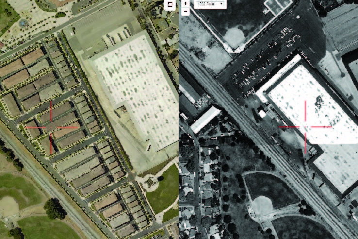
Aerial Photos — Historoscope
The Historoscope is our aerial photo comparison tool. Browse around and investigate how the City of Hayward has changed through the years.
Updated on April 17, 2017
Image

Cannabis Land Use
The Adult Use of Marijuana Act (AUMA), California Proposition 64, provides for large-scale cultivation, manufacturing, distribution and sale of cannabis for adult recreational use. Use the app or pdfs below to find the allowable locations in Hayward for cannabis businesses.
Updated on August 14, 2019
Image
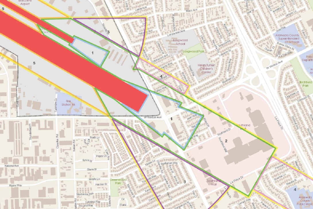
Airport Safety Zones
The Airport Safety Zones are used in the Airport Approach Zoning Ordinance. The law is to promote the health, safety and general welfare of the inhabitants of the City of Hayward by preventing the creation or establishment of airport hazards, thereby protecting the lives and property of the users of the Hayward Air Terminal and of the occupants of the land in its vicinity, and preventing destruction or impairment of the utility of the airport and the public investment therein.
updated June 15, 2017
Hayward Parcel Explorer
A parcel is a piece or unit of land meant to be owned by one or more person(s) or another legal entity such as a company, corporation, organization, government or trust. Explore where there are potential vacant parcels, and which parcels the City of Hayward owns.
updated on Sept 20, 2017
Hayward Streets Explorer
The Hayward Streets layer has more than just names and addresses. Take a look at some of the other attributes that we track in our GIS street layer.
updated on Sept 20, 2017
Image
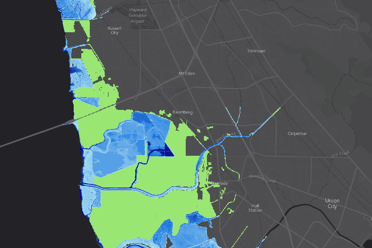
Sea Level Rise
These maps were created as part of the Adapting to Rising Tides project of the San Francisco Bay Conservation and Development Commission.
Updated August 4, 2017
Image

Bicycle Network (Routes, Paths, Lanes)
The Hayward Bicycle Route System includes multiple types of bicycling infrastructure, including off-road paths (Class I), bicycle lanes (Class II), and low-traffic roads (Class III). View the data in a web map, or download the data from our open data portal to create your own application.
Updated on Aug 31, 2017
Image
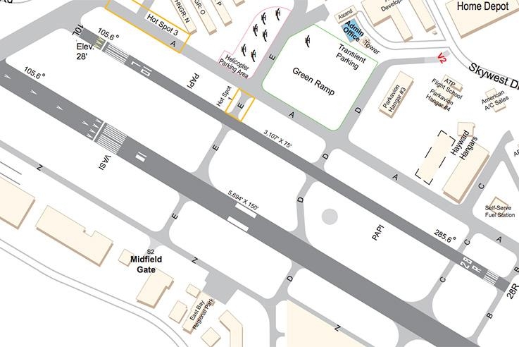
Executive Airport Site Map
Hayward Executive Airport meets the travel needs of local private pilots and their passengers, and we welcome visitors from around the country. This vibrant general aviation airport is home to over 400 aircraft including business jets, and it provides over 300 jobs and $300 million in annual economic benefits to the community.
Updated on July 24, 2016
Image
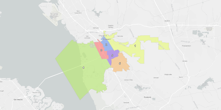
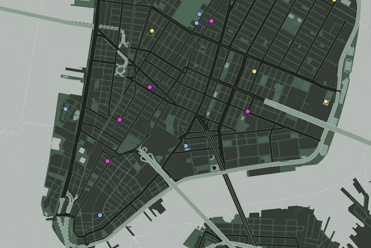
Police Districts
During each shift, patrol officers are deployed into specific geographic areas called “districts.”
Updated on Mar 3, 2026