


Stratford Village Flood Prevention Project
What is the Stratford Village Stormwater Lift Station?
In 1992, as part of the Stratford Village neighborhood pre-development analysis, it was determined that the neighborhood was located below the 100-year flood zone. Due to the risk of flooding, the development conditions of approval required extensive grading to raise the elevation of the property to receive approvals from the City. Development of the neighborhood was eventually made possible with the construction of a dedicated stormwater lift station, built in 1995, to service only this specific neighborhood. A Maintenance District was put into place as a mechanism for the property owners to fund the station’s operation, maintenance, and capital replacement in perpetuity. This lift station is the only privately built stormwater lift station in the City, initially funded by the developer, and able to be operated and maintained, with capital items being repaired and replaced solely with property tax special assessment revenue collected from the benefited property owners.
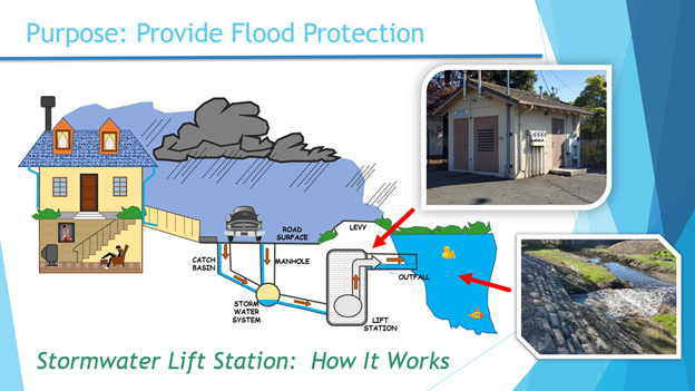
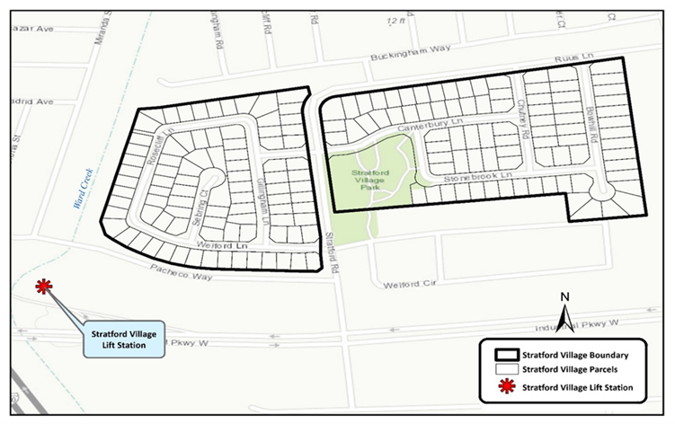
The Stratford Village neighborhood is located within a large drainage basin and the Ward Creek drainage facilities run along the western edge of the neighborhood. The Stratford Village Stormwater Lift Station, located at the end of Pacheco Way in the southwestern corner of Stratford Village, pumps water out of the neighborhood into a drainage facility (Ward Creek). A diagram of how stormwater is collected and pumped out of the flood control drainage facility is below.
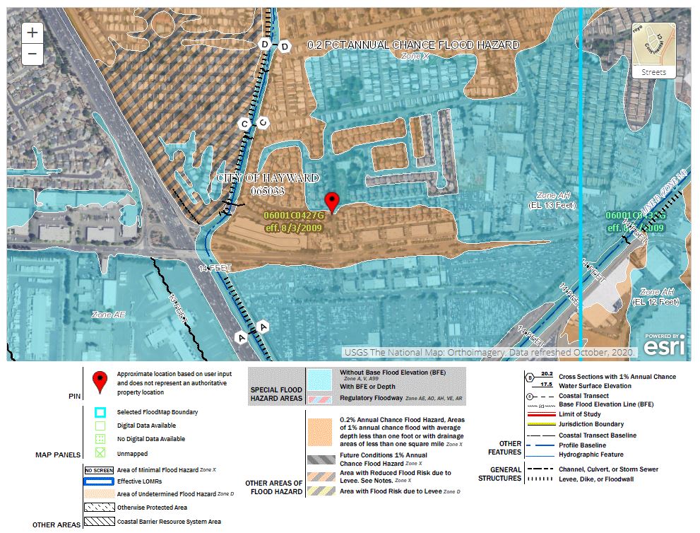
Properties located in the Stratford Village neighborhood are at an elevated risk of flooding without properly maintained storm drainage facilities. In fact, many of the local streets, and some properties, are within a “Special Flood Hazard Area,” as identified by Federal Emergency Management Agency (FEMA) engineers. During large storm events, Stratford Village streets are subject to flooding, which can cause property damage, loss of power, effect sewer and water services, impede safe navigation, and prevent access by emergency responders, including police and fire services.
How is the Stormwater Lift Station funded?
Each of the 174 property owners currently contributes $243.92 per year for the maintenance of this critical flood protection infrastructure. Annually, $42,442 in assessment revenue is collected. These funds are maintained and spent only for the operation, maintenance, repair, and replacement of this neighborhood’s lift station. The annual maximum charge rate (assessment) was set when the neighborhood was developed in 1995 and cannot be increased without property owner approval. Twenty-five years later, the funds generated from the annual property special assessments are no longer sufficient to properly operate and maintain the Stratford Village Stormwater Lift Station and to provide for repair and replacement of capital assets.
Maintenance Districts like this one, created prior to 1996, were often created without the forethought of considering an increase in future costs and did not include an annual inflation factor to increase the annual charge rate. If an inflation factor had been included in the original formation of Maintenance District #1, then the maximum annual special assessment rate would have increased from $243.92 in 1995 to $494.95 in 2021.
What is needed to continue to maintain the Stormwater Lift Station?
Twenty-five years later, current funds generated from the annual property special assessments are no longer sufficient to properly operate and maintain the Stratford Village Stormwater Lift Station and provide the needed repair and replacement of capital assets for the station to operate at its original, intended, and needed level of service.
Through a series of mailers, virtual community meetings (listed below), and virtual City Council meetings, staff is seeking input from Stratford Village property owners regarding the best path forward to protect Stratford Village from flooding.
Who should provide input?
This assessment district is for the property owners of the parcel(s) identified below by Assessment Parcel Numbers (APN) that are located within Maintenance District #1 (Stratford Village), in the City of Hayward.
Important Meetings and Dates:
Council Meeting - Staff Report and Presentation
June 22, 2021 at 7pm (to tabulate ballots)
Related Documents
- Community Letter sent Feb. 12, 2021
- Community Meeting Materials presented Feb. 25, 2021
- City Council Report March 23, 2021
- Community Meeting Materials presented April 14, 2021
- City Council Report May 4, 2021
- City Council Report June 22, 2021
Flood Information
Questions? Contact:
Denise Blohm, Management Analyst, Maintenance Services Department
denise.blohm@hayward-ca.gov